Snowpack Summary for Friday, February 10, 2017 9:35 PM Stability continues to increase. Watch for new storm/wind slab formation.
This summary expired Feb. 12, 2017 9:35 PM
Flagstaff, Arizona - Backcountry of The San Francisco Peaks and Kachina Peaks Wilderness
On Friday, February 10th, a small windslab avalanche crown line was observed near 10500' on ~NE slopes of Cleaver Ridge in the Inner Basin. It looked less than 10 days old, but we are unsure.
There were reports on February 10th of small wet avalanches triggered by skiers on the warm southerly slopes of Core Ridge. We anticipate a decrease of wet snow reactivity above 10000' over the next 24 hours. It may become an issue again by next Thursday, February 16th.
Warm temperatures did not appear to produce widespread wet avalanche activity on Friday, February 10th, possibly due to breezy conditions helping to evaporate excess moisture on the snow surface. Aside from rapid midday warming creating unstable wet snow, the unseasonably warm temperatures have contributed to snowpack bonding, strengthening and densification.
We continue to find evidence of some poor structure in our snowpack, but high strength and generally low reactivity during stability tests leads us to conclude that avalanches are unlikely. However, new snow and wind may create slabs over the weekend, increasing their likelihood.
Pit data from last weekend.
Current forecast calls for cooler temperatures, and by Saturday, wet slide potential will drop to improbable.
Coverage is great above 9000'. The warm temps have melted much of the "POTUS Inauguration Trifecta Storm" snow below 8000', especially on sunny slopes.
Current Problems (noninclusive) more info

Wind slabs usually stabilize in less than a week, so you can reduce your risk by waiting several days after a big loading event.

Images
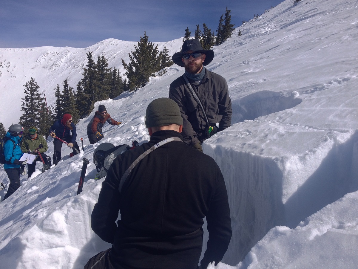
Digging snow pits with the Level I Avalanche Course last weekend, February 3-5, 2017.
Final Thoughts
Travelers are advised to exercise caution, make slope specific evaluations and most of all, know where you are going and be prepared for the unexpected.
As always, please treat this summary with appropriately guarded skepticism, make your own assessments, and contribute to our body of knowledge by reporting your observations.
Arizona Snowbowl uphill policy.
Want to learn more safe backcountry habits? KPAC offers level I and II avalanche courses. There is one class left this season.
During winter, backcountry permits are required to access the Kachina Peaks Wilderness. More info
Weather
After a cloudy, cool and moist start last week, high pressure moved in on Wednesday and Thursday bringing temperatures 10 to 20° F above normal to northern Arizona. Above freezing temperatures were recorded at the Agassiz Peak Station (11500') between 8 pm on February 8th and the time of publication of this summary on February 10th. A 46° F high temperature was continuously recorded for most of Thursday afternoon at the Agassiz Peak Station while the Snowslide SNOTEL ramped up to a scorching 55° F during the same period. Winds have been light and variable, primarily out of the west and northwest, shifting to southwesterly and gusting into the low teens on Thursday afternoon.
As the weekend arrives, so does a low pressure system and cold front, bringing cloudy skies, a cooling trend and light to moderate high elevation snowfall. These conditions will last through the weekend. Snow accumulation is expected to range between 8 and 14 inches at elevations above 10000' accompanied by southwesterly winds of 20-35 mph.
High pressure is expected to return and build through next week with seasonally normal temperatures and clear skies.
Weather station information:
On the morning of Friday February 10th, the Inner Basin SNOTEL site (Snowslide) reported a snow depth of 71 inches (180 cm) at 9700’, and Arizona Snowbowl reported 79 inches (201 cm) at 10800’. Since February 3rd, SNOTEL temperatures ranged between 29° and 55° F, and Agassiz station between 19° and 46° F.
Authored/Edited By: Derik Spice, David Lovejoy, Troy Marino
Avalanche Problems/Characters
The avalanche problem/character describes part of the current avalanche danger. However because we only realease a summary once a week, the current avalanche problem will likely change.
Understanding avalanche problems is essential, because it allows you to determine your approach and strategies to risk treatment. Below are brief descriptions of avalanche problems/characters, and links to detailed information on the problem, formation, patterns, recognition, and avoidance strategies.
Avalanche Problems Explained
Also see the North American Danger Scale.
Loose Dry

Release of dry unconsolidated snow. These avalanches typically occur within layers of soft snow near the surface of the snowpack. Loose-dry avalanches start at a point and entrain snow as they move downhill, forming a fan-shaped avalanche. Other names for loose-dry avalanches include point-release avalanches or sluffs. Loose-dry avalanches can trigger slab avalanches that break into deeper snow layers.
Loose Dry avalanches are usually relatively harmless to people. They can be hazardous if you are caught and carried into or over a terrain trap (e.g. gully, rocks, dense timber, cliff, crevasse) or down a long slope. Avoid traveling in or above terrain traps when Loose Dry avalanches are likely. more info
Storm Slab
Release of a soft cohesive layer (a slab) of new snow that breaks within the storm snow or on the old snow surface. Storm-slab problems typically last between a few hours and few days. Storm-slabs that form over a persistent weak layer (surface hoar, depth hoar, or near-surface facets) may be termed Persistent Slabs or may develop into Persistent Slabs.
You can reduce your risk from Storm Slabs by waiting a day or two after a storm before venturing into steep terrain. Storm slabs are most dangerous on slopes with terrain traps, such as timber, gullies, over cliffs, or terrain features that make it difficult for a rider to escape off the side. more info
Wind Slab
Release of a cohesive layer of snow (a slab) formed by the wind. Wind typically transports snow from the upwind sides of terrain features and deposits snow on the downwind side. Wind slabs are often smooth and rounded and sometimes sound hollow, and can range from soft to hard. Wind slabs that form over a persistent weak layer (surface hoar, depth hoar, or near-surface facets) may be termed Persistent Slabs or may develop into Persistent Slabs.
Wind Slabs form in specific areas, and are confined to lee and cross-loaded terrain features. They can be avoided by sticking to sheltered or wind-scoured areas. more info
Persistent Slab

Release of a cohesive layer of soft to hard snow (a slab) in the middle to upper snowpack, when the bond to an underlying persistent weak layer breaks. Persistent layers include: surface hoar, depth hoar, near-surface facets, or faceted snow. Persistent weak layers can continue to produce avalanches for days, weeks or even months, making them especially dangerous and tricky. As additional snow and wind events build a thicker slab on top of the persistent weak layer, this avalanche problem may develop into a Deep Persistent Slab.
The best ways to manage the risk from Persistent Slabs is to make conservative terrain choices. They can be triggered by light loads and weeks after the last storm. The slabs often propagate in surprising and unpredictable ways. This makes this problem difficult to predict and manage and requires a wide safety buffer to handle the uncertainty. more info
Deep Persistent Slab

Release of a thick cohesive layer of hard snow (a slab), when the bond breaks between the slab and an underlying persistent weak layer, deep in the snowpack or near the ground. The most common persistent weak layers involved in deep, persistent slabs are depth hoar or facets surrounding a deeply buried crust. Deep Persistent Slabs are typically hard to trigger, are very destructive and dangerous due to the large mass of snow involved, and can persist for months once developed. They are often triggered from areas where the snow is shallow and weak, and are particularly difficult to forecast for and manage. They commonly develop when Persistent Slabs become more deeply buried over time.
Deep Persistent Slabs are destructive and deadly events that can take months to stabilize. You can trigger them from well down in the avalanche path, and after dozens of tracks have crossed the slope. more info
Loose Wet

Release of wet unconsolidated snow or slush. These avalanches typically occur within layers of wet snow near the surface of the snowpack, but they may quickly gouge into lower snowpack layers. Like Loose Dry Avalanches, they start at a point and entrain snow as they move downhill, forming a fan-shaped avalanche. They generally move slowly, but can contain enough mass to cause significant damage to trees, cars or buildings. Other names for loose-wet avalanches include point-release avalanches or sluffs. Loose Wet avalanches can trigger slab avalanches that break into deeper snow layers.
Travel when the snow surface is colder and stronger. Plan your trips to avoid crossing on or under very steep slopes in the afternoon. Move to colder, shadier slopes once the snow surface turns slushly. Avoid steep, sunlit slopes above terrain traps, cliffs areas and long sustained steep pitches. more info
Wet Slab

Release of a cohesive layer of snow (a slab) that is generally moist or wet when the flow of liquid water weakens the bond between the slab and the surface below (snow or ground). They often occur during prolonged warming events and/or rain-on-snow events. Wet Slabs can be very destructive.
Avoid terrain where and when you suspect Wet Slab avalanche activity. Give yourself a wide safety buffer to handle the uncertainty. more info
Cornice Fall

Cornice Fall is the release of an overhanging mass of snow that forms as the wind moves snow over a sharp terrain feature, such as a ridge, and deposits snow on the downwind (leeward) side. Cornices range in size from small wind lips of soft snow to large overhangs of hard snow that are 30 feet (10 meters) or taller. They can break off the terrain suddenly and pull back onto the ridge top and catch people by surprise even on the flat ground above the slope. Even small cornices can have enough mass to be destructive and deadly. Cornice Fall can entrain loose surface snow or trigger slab avalanches.
Cornices can never be trusted and avoiding them is necessary for safe backcountry travel. Stay well back from ridge line areas with cornices. They often overhang the ridge edge can be triggered remotely. Avoid areas underneath cornices. Even small Cornice Fall can trigger a larger avalanche and large Cornice Fall can easily crush a human. Periods of significant temperature warm-up are times to be particularly aware.
Large cornices are generally rare in Arizona, but they have been observed during very snowy winters. more info
Glide

Release of the entire snow cover as a result of gliding over the ground. Glide avalanches can be composed of wet, moist, or almost entirely dry snow. They typically occur in very specific paths, where the slope is steep enough and the ground surface is relatively smooth. The are often proceeded by full depth cracks (glide cracks), though the time between the appearance of a crack and an avalanche can vary between seconds and months. Glide avalanches are unlikely to be triggered by a person, are nearly impossible to forecast, and thus pose a hazard that is extremely difficult to manage.
Predicting the release of Glide Avalanches is very challenging. Because Glide Avalanches only occur on very specific slopes, safe travel relies on identifying and avoiding those slopes. Glide cracks are a significant indicator, as are recent Glide Avalanches.
Glide avalanches are very uncommon in Arizona. more info
