Snowpack Summary for Friday, March 15, 2019 7:20 PM 12 to 18" inches of new snow near treeline with strong winds
This summary expired Mar. 17, 2019 7:20 PM
Flagstaff, Arizona - Backcountry of The San Francisco Peaks and Kachina Peaks Wilderness
Some isolated storm slab instabilities were noted on March 14th, near 11,000’ on SE slopes of Core Ridge. However the potential for crack propagation appeared low at that location. Also, we found no significant wind slabs on E and SE slopes near treeline. Much of the transported snow was sublimated to the atmosphere, rather than formed into wind slabs. However, due to obscured and cloudy conditions, we did not get good views of much of the mountains, and we suspect that wind slab development is likely. Human triggered wind slab avalanches may be likely near and above treeline.
Winter continued this past week with another storm cycle and N to NW winds of 20-40 mph at treeline.That event brings the season snowfall total to over 300" at 10,800'.
Overall the snowpack structure exhibits a wide variety of characteristics based on aspect and elevation. At treeline on N, W and SW aspects, the snowpack has moderate strength, poor to moderate structure and low to moderate energy. Last weekend on northerly slopes of Doyle, we found large temperature gradients forming near surface facets. At that time, those weak layers did not show propagation propensity.
No significant avalanches or unstable snow reported since February.
Read more about BJ's tour, and spring travel advice.
This tour was post storm cycle of 18 inches reported by ASB. The storm did make history as a "Bomb Cyclone" as it moved off to the East. We did get quite bit of wind out of the NW during and after the event. East winds today with good "Wrap around moisture". The Wind densified the snowpack and created some storm slab on some aspects. No cracking, whumping or other avalanche activity was observed on our tour. All data has been recorded on the Project worksheet. Snow distribution and measurements ranged from wind scoured treeline site at 20 cm to 249 cm at Midway catwalk Historical ASB site.
This storm cycle started very warm and wet producing right side up snowpack with significant wind transport. Ski conditions are the best its been in years. We descended the Pro Bass Tour of 7 Meadows in 12 to 18 inches of consistent powder. A bit densified near treeline, but fluffy below. Snowpack overall on our tour showing good stability, no energy, fair structure and good strength.
We are getting close to the spring equinox and it is time to think about spring travel strategies.
Expect to find wind scoured zones and hard icy snow above treeline. Crampons and ice axes will help prevent falls on steep icy slopes.
Sunshine after storms may destabilize new storm/wind slabs, primarily on southerly and sunny slopes.
Current Problems (noninclusive) more info

The most recent winds are from the east-northeast. Watch for new slabs on west and southwest slopes. Expect wind directions to change.
Wind slabs are often smooth and rounded and sometimes sound hollow, and can range from soft to hard. Avoid slabs and convex pillows of wind-drifted snow on lee and cross-loaded terrain features.
Waiting at least 48 hours after wind events will decrease your chances of finding unstable storm/wind slabs.

Avoid traveling on and below steep sun affected slopes after midday, earlier on very warm days. Rain on snow events may also lead to wet slab releases.

Images
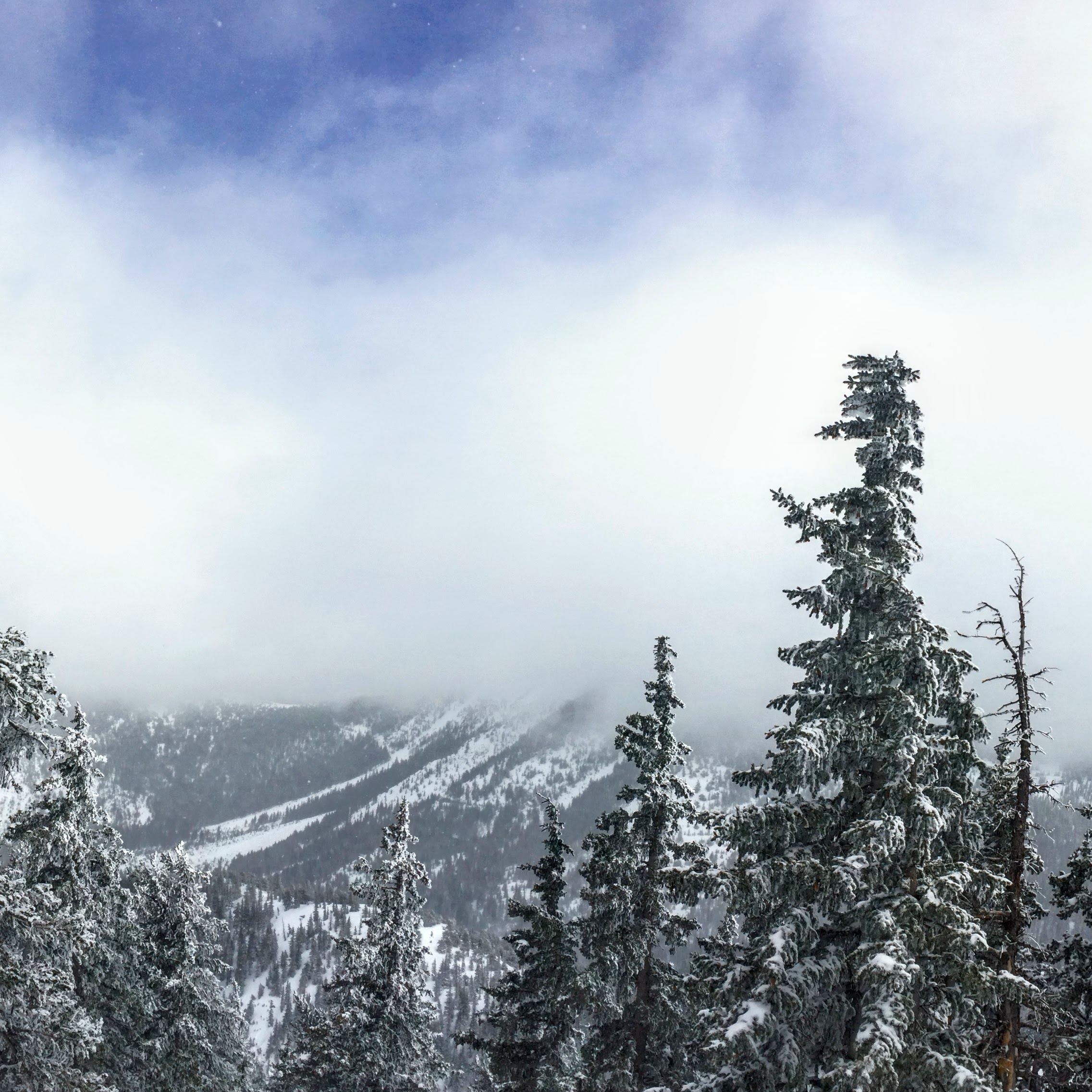
Weather obscured our Inner Basin observations on Thursday.
Final Thoughts
Logging work will start in the near future along the first 1/4 mile of Freidlein Prairie Road (FR-522). Loggers will plow that stretch of road and need gate access. This is part of the Chimney Springs thinning project.
Backcountry permits are required for travel in the Kachina Peaks Wilderness and available at local USFS locations, as well as, at the Agassiz Lodge on Saturday and Sunday 8:30 -11:30.
For information on uphill travel within the Arizona Snowbowl ski area, please refer to www.flagstaffuphill.com and https://www.snowbowl.ski/the-mountain/uphill-access/ for details. Access to the Kachina Peaks Wilderness is available from the lower lots at Snowbowl via the Humphreys Trail and Kachina Trail.
Weather
Over the week, 18” of new snow was recorded at 10,800’ on Arizona Snowbowl. The snowline started out at ~7500’ and dropped to 5500’ by its culmination on Wednesday morning March 13th. Snow transporting winds out of the southwest kicked up on Tuesday night, with post-frontal winds shifting to the north and northwest on Wednesday midday. Cold temperatures, breezy winds and lingering snow flurries characterized the aftermath of the storm, but with little further snow accumulation.
Mostly sunny skies, with seasonally average temperatures, are on tap for the weekend. Renewed chances of snow showers are foretasted for early in the workweek, but with little prospect of significant accumulation. A better chance for a more productive storm will arrive midweek, but this low pressure trough is currently too far away for accurate predictions of trajectory, precipitation potential or precise timing of impact.
On Thursday, March 14th, the Inner Basin SNOTEL site (Snowslide) reported a snow depth of 74” (188 cm) at 9,730'. Arizona Snowbowl reported a settled base of 98” (249 cm) at 10,800'. So far this winter, 306" (777 cm) of snow has fallen at the mid-mountain study site. Since March 8th, SNOTEL temperatures have ranged between -1° F on March 14th, and 38° F also on March 9th and 13th. For the same period, ASBTP (11,555') reported temperatures between 3.5° F on March 14th, and 30.5° F on March 12th.
Authored/Edited By: Derik Spice, David Lovejoy, Troy Marino
Avalanche Problems/Characters
The avalanche problem/character describes part of the current avalanche danger. However because we only realease a summary once a week, the current avalanche problem will likely change.
Understanding avalanche problems is essential, because it allows you to determine your approach and strategies to risk treatment. Below are brief descriptions of avalanche problems/characters, and links to detailed information on the problem, formation, patterns, recognition, and avoidance strategies.
Avalanche Problems Explained
Also see the North American Danger Scale.
Loose Dry

Release of dry unconsolidated snow. These avalanches typically occur within layers of soft snow near the surface of the snowpack. Loose-dry avalanches start at a point and entrain snow as they move downhill, forming a fan-shaped avalanche. Other names for loose-dry avalanches include point-release avalanches or sluffs. Loose-dry avalanches can trigger slab avalanches that break into deeper snow layers.
Loose Dry avalanches are usually relatively harmless to people. They can be hazardous if you are caught and carried into or over a terrain trap (e.g. gully, rocks, dense timber, cliff, crevasse) or down a long slope. Avoid traveling in or above terrain traps when Loose Dry avalanches are likely. more info
Storm Slab

Release of a soft cohesive layer (a slab) of new snow that breaks within the storm snow or on the old snow surface. Storm-slab problems typically last between a few hours and few days. Storm-slabs that form over a persistent weak layer (surface hoar, depth hoar, or near-surface facets) may be termed Persistent Slabs or may develop into Persistent Slabs.
You can reduce your risk from Storm Slabs by waiting a day or two after a storm before venturing into steep terrain. Storm slabs are most dangerous on slopes with terrain traps, such as timber, gullies, over cliffs, or terrain features that make it difficult for a rider to escape off the side. more info
Wind Slab
Release of a cohesive layer of snow (a slab) formed by the wind. Wind typically transports snow from the upwind sides of terrain features and deposits snow on the downwind side. Wind slabs are often smooth and rounded and sometimes sound hollow, and can range from soft to hard. Wind slabs that form over a persistent weak layer (surface hoar, depth hoar, or near-surface facets) may be termed Persistent Slabs or may develop into Persistent Slabs.
Wind Slabs form in specific areas, and are confined to lee and cross-loaded terrain features. They can be avoided by sticking to sheltered or wind-scoured areas. more info
Persistent Slab

Release of a cohesive layer of soft to hard snow (a slab) in the middle to upper snowpack, when the bond to an underlying persistent weak layer breaks. Persistent layers include: surface hoar, depth hoar, near-surface facets, or faceted snow. Persistent weak layers can continue to produce avalanches for days, weeks or even months, making them especially dangerous and tricky. As additional snow and wind events build a thicker slab on top of the persistent weak layer, this avalanche problem may develop into a Deep Persistent Slab.
The best ways to manage the risk from Persistent Slabs is to make conservative terrain choices. They can be triggered by light loads and weeks after the last storm. The slabs often propagate in surprising and unpredictable ways. This makes this problem difficult to predict and manage and requires a wide safety buffer to handle the uncertainty. more info
Deep Persistent Slab

Release of a thick cohesive layer of hard snow (a slab), when the bond breaks between the slab and an underlying persistent weak layer, deep in the snowpack or near the ground. The most common persistent weak layers involved in deep, persistent slabs are depth hoar or facets surrounding a deeply buried crust. Deep Persistent Slabs are typically hard to trigger, are very destructive and dangerous due to the large mass of snow involved, and can persist for months once developed. They are often triggered from areas where the snow is shallow and weak, and are particularly difficult to forecast for and manage. They commonly develop when Persistent Slabs become more deeply buried over time.
Deep Persistent Slabs are destructive and deadly events that can take months to stabilize. You can trigger them from well down in the avalanche path, and after dozens of tracks have crossed the slope. more info
Loose Wet

Release of wet unconsolidated snow or slush. These avalanches typically occur within layers of wet snow near the surface of the snowpack, but they may quickly gouge into lower snowpack layers. Like Loose Dry Avalanches, they start at a point and entrain snow as they move downhill, forming a fan-shaped avalanche. They generally move slowly, but can contain enough mass to cause significant damage to trees, cars or buildings. Other names for loose-wet avalanches include point-release avalanches or sluffs. Loose Wet avalanches can trigger slab avalanches that break into deeper snow layers.
Travel when the snow surface is colder and stronger. Plan your trips to avoid crossing on or under very steep slopes in the afternoon. Move to colder, shadier slopes once the snow surface turns slushly. Avoid steep, sunlit slopes above terrain traps, cliffs areas and long sustained steep pitches. more info
Wet Slab
Release of a cohesive layer of snow (a slab) that is generally moist or wet when the flow of liquid water weakens the bond between the slab and the surface below (snow or ground). They often occur during prolonged warming events and/or rain-on-snow events. Wet Slabs can be very destructive.
Avoid terrain where and when you suspect Wet Slab avalanche activity. Give yourself a wide safety buffer to handle the uncertainty. more info
Cornice Fall
Cornice Fall is the release of an overhanging mass of snow that forms as the wind moves snow over a sharp terrain feature, such as a ridge, and deposits snow on the downwind (leeward) side. Cornices range in size from small wind lips of soft snow to large overhangs of hard snow that are 30 feet (10 meters) or taller. They can break off the terrain suddenly and pull back onto the ridge top and catch people by surprise even on the flat ground above the slope. Even small cornices can have enough mass to be destructive and deadly. Cornice Fall can entrain loose surface snow or trigger slab avalanches.
Cornices can never be trusted and avoiding them is necessary for safe backcountry travel. Stay well back from ridge line areas with cornices. They often overhang the ridge edge can be triggered remotely. Avoid areas underneath cornices. Even small Cornice Fall can trigger a larger avalanche and large Cornice Fall can easily crush a human. Periods of significant temperature warm-up are times to be particularly aware.
Large cornices are generally rare in Arizona, but they have been observed during very snowy winters. more info
Glide

Release of the entire snow cover as a result of gliding over the ground. Glide avalanches can be composed of wet, moist, or almost entirely dry snow. They typically occur in very specific paths, where the slope is steep enough and the ground surface is relatively smooth. The are often proceeded by full depth cracks (glide cracks), though the time between the appearance of a crack and an avalanche can vary between seconds and months. Glide avalanches are unlikely to be triggered by a person, are nearly impossible to forecast, and thus pose a hazard that is extremely difficult to manage.
Predicting the release of Glide Avalanches is very challenging. Because Glide Avalanches only occur on very specific slopes, safe travel relies on identifying and avoiding those slopes. Glide cracks are a significant indicator, as are recent Glide Avalanches.
Glide avalanches are very uncommon in Arizona. more info
