Snowpack Summary for Monday, January 23, 2017 5:10 PM Dangerous Avalanche Conditions
This summary expired Jan. 25, 2017 5:10 PM
Flagstaff, Arizona - Backcountry of The San Francisco Peaks and Kachina Peaks Wilderness
Overall
As of midday on Sunday January 22 storm totals had exceeded those forecasted for high elevations. By that time, Arizona Snowbowl had received 53 inches in 48 hours, with a snow depth of 90 inches at 10,800’. On Sunday, Snowslide SNOTEL, site at 9730’ in the Inner Basin, reported 81 inches (settling to 78 inches) with an accumulation of about 24 inches for the first two of three storms. Three inches of snow water equivalent (SWE) had loaded a poorly structured snowpack.
On Saturday, explosive mitigation instigated by the Snowbowl ski patrol produced a large avalanche from near the false summit of Agassiz Peak. This slide ran nearly 800’ to the radar sign on the ski area. It had a crown thickness of 2 to 4’, and was initiated by only 2 pounds of explosive. This indicates the potential magnitude of natural and skier trigger avalanches.
Arizona Snowbowl uphill access is closed until further notice.
Avalanche Danger: Snowpack stability will continue to be precarious for at least the next 48 hours.
Backcountry travelers need to be patient and allow new snow to bond with old and gain strength. Travel in avalanche terrain is NOT recommended for the next 24 hours after the cessation of precipitation. Instabilities could remain tenuous for an extended period of time. Further snow pit investigations later next week will inform us about rates of stabilization. Stay tuned and share your own observations and snow pit results.
As of Sunday morning total snowfall for the season at 10,800’ was 194 inches. This is 3/4 of our average total annual snowfall; pretty remarkable for the third week in January and another 2 feet forecasted for the third storm.
From Arizona Snowbowl:
Spur Catwalk is closed due to avalanche danger. Please access Bowl Side trails via Midway Catwalk. Upper Bowl will be closed likely through Tuesday. Avalanche control work is in progress and Uphill Access is closed until further notice. This will likely be in effect through Tuesday for avalanche control work.
Near and Above TreelineVery dangerous avalanche conditions. Travel in (or near) avalanche terrain NOT recommended.
Below TreelinePow riding in the trees is all time right now. Keep your slope angles below 30° and watch for steep isolated terrain traps in gullys. Tree well hazards may be an issue in our deeping snowpack.
More discussion in the last summary update.
More discussion in the last summary update.
Current Problems (noninclusive) more info

New storm snow will need time to bond with the old snowpack. This generally happens within 24-48 hours after the end of precipitation. Storm slab avalanche hazards will continue into midweek and possibly beyond. Forecasted cold temperatures will prolong bonding of storm snow with layers below.

Optimum wind speeds for the transport of snow are currently in progress, and there is plenty of snow available to move. Higher velocity winds are also expected. Wind Slab avalanche hazards will continue into midweek and possibly beyond. Forecasted cold temperatures will prolong bonding of storm snow with layers below.

Avalanches may step down onto persistent weak layers deeper in the snowpack increasing the potential mass moving downslope. Discussed more in the last summary update.
Images

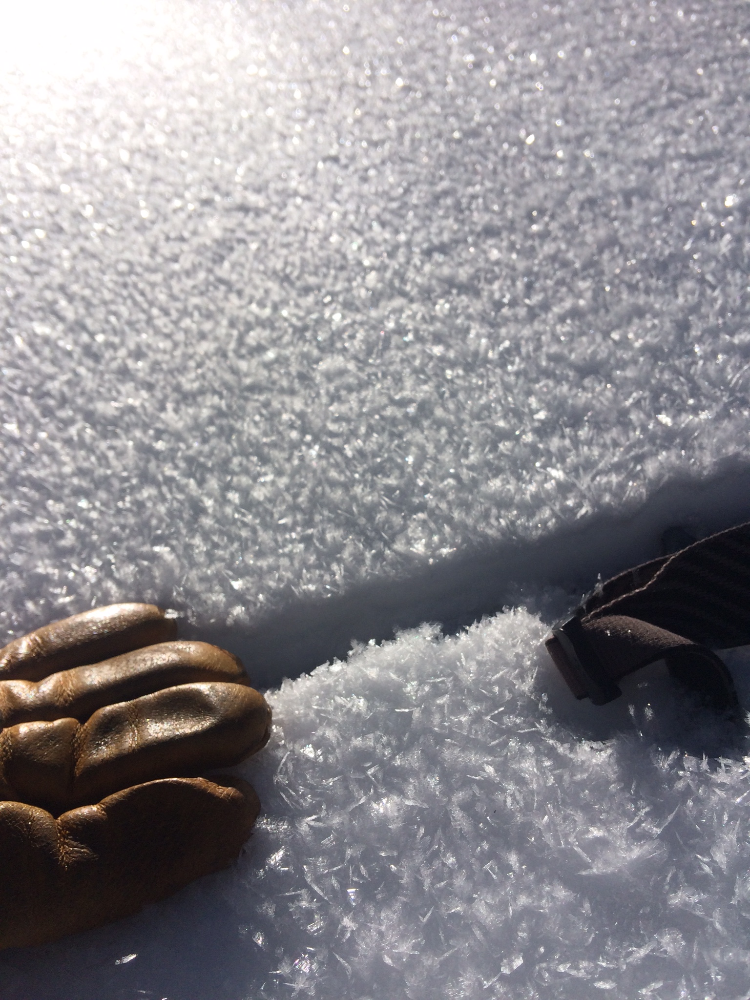
Inner Basin surface hoar, January 18, 2017. Steep slopes with surface hoar buried by new snow is a deadly combination. Photo by Derik Spice.
Final Thoughts
Travelers are advised to exercise caution and make slope specific evaluations. As always, please treat this summary with appropriately guarded skepticism, make your own assessments, and contribute to our body of knowledge by reporting your observations.
Want to learn more safe backcountry habits? KPAC offers level I and II avalanche courses. They are filling up fast!!!
During winter, backcountry permits are required to access the Kachina Peaks Wilderness. More info
Note: Uphill access has opened at Arizona Snowbowl. It may be restricted or closed due to heavy snow and avalanche danger. Access to the Humphreys Summit trailhead is always available from the lower lots of the ski area, below the gate. Travel safe! arizonasnowbowl.com/safety
Weather
Last updated on Friday, January 20, 2017.
As KNAU’s Gillian Ferris says, "a winter storm trifecta" is currently impacting our region, as well as, large portions of western United States. These storms will bring the most intense winter precipitation we have had this season. Snowfall total could potentially exceed 24 inches and load the old snowpack with 2-3 inches of snow water equivalent (SWE).
The first pulse was a short wave trough, starting on Thursday and was forecasted to lay down less than a foot at higher elevation. Snow level started at 6000 feet and dropped to 5000 feet by Thursday night. Snowfall will taper off on Friday morning.
A second pulse arrives on Friday evening and lasts through Saturday morning. This slightly longer wave trough will have the greatest precipitation potential. We anticipate heavy snowfall with accumulations in the 1 to 1.5 foot range above 10000 ft.
A fast moving short wave ridge will create another brief break until a third colder pulse arrives on Sunday night. Atmospheric instability is expected to last into midweek with lingering snow showers. Snowline will drop to 4500 feet, with breezy winds out of the southwest lingering. Subfreezing maximum temperatures and moderate winds will prevail for the first half of the workweek above 7000 ft.
Station Information:
On the morning of Friday January 20th the Inner Basin SNOTEL site (Snowslide) reported a snow depth of 68 inches (173 cm) at 9700 ft, and Arizona Snowbowl reported 79 inches (201 cm) at 10800 ft. These values are expected to increase dramatically as heavy precipitation continues periodically for the next several days. Since January 14 the SNOTEL temperatures ranged between 11 and 35°F and Agassiz station between 12 and 25°F.
Authored/Edited By: Derik Spice, David Lovejoy, Troy Marino


